 Electoral Area F (Vanderhoof Rural)
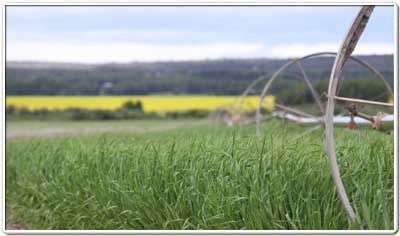
Electoral Area F (Vanderhoof Rural) is the rural area surrounding the District of Vanderhoof. The unincorporated communities within the area are Engen and Cluculz Lake. Electoral Area F lies within the interior plateau of BC. The terrain is dominated by gently rolling hills, covered with pine and spruce forests and fertile agricultural lands. Although considered 'flat', the area also has some interesting topography including steep rocky bluffs, waterfalls, and mountains. The area is also rich with lakes and rivers that abound with sport fish and other wildlife.
The landscape of Area F is the foundation of the forestry and agriculture industries.
Regional District of Bulkley-Nechako Elected Representative
|
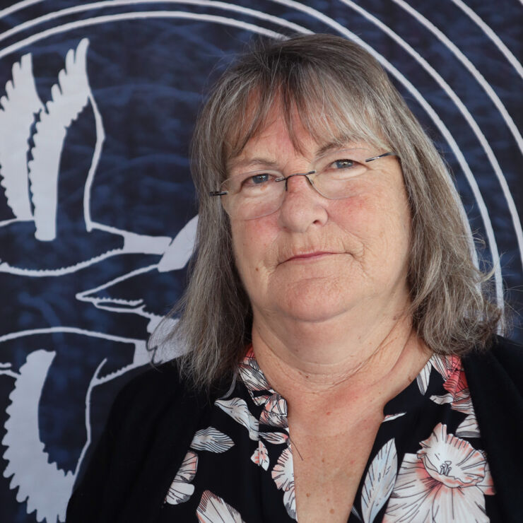
Director Shirley Moon |
37 3rd Avenue
Burns Lake, BC V0J 1E0
Phone: (250) 692-3195
Toll Free: 1-800-320-3339
Fax: (250) 692-3305
Website: www.rdbn.bc.ca
Local First Nations
Vanderhoof and Surrounding Area Profile
Electoral Area F (Vanderhoof Rural) Population: 3,517
*2021 Census Data
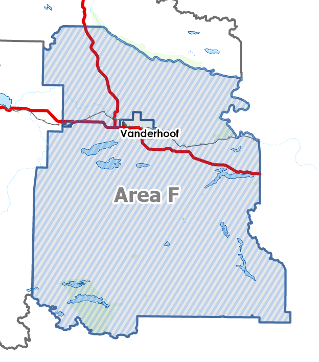
Electoral Area F (Vanderhoof Rural) Boundaries
|
Western Boundary (Hwy 16):
Western Boundary (Fawcett Road):
Western Boundary (Telegraph Road):
Western Boundary (Kenny Dam Road):
Eastern Boundary (Hwy 16):
Northern Boundary (Hwy 27):
|
 |
Local services provided by the RDBN in Electoral Area F (Vanderhoof Rural)
| Building Inspection |
| Building Numbering |
| Development Services |
| Economic Development |
| Electoral Area Planning |
| Emergency Preparedness |
| Grants-in-Aid |
| Environmental Services |
| Weed Control |
| 9-1-1 |
| Feasibility Studies |
| Liquid/Solid Waste Disposal |
| Rural Government Services |
| Recreation and Culture |
| Emergency Services |
| Pump and Haul Sewer Disposal |
| Cluculz Lake Emergency Response |
| Cluculz Lake – Somerset Estates Sewer |
| Rural Fire Protection |
| General Government Services |
| Extrication |
| Planning and Zoning |