 Electoral Area G
(Houston/Granisle Rural)
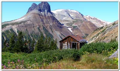
Electoral Area G (Houston/Granisle Rural) is the rural area surrounding the District of Houston and the Village of Granisle. The unincorporated communities within the area are Fort Babine, Kuldo, Smithers Landing, Topley, and Topley Landing. The area offers natural landscapes of lakes and rivers, as well as scenic drives that allow travellers and residents to take in the wilderness of central BC. The rural area has a population of approximately 1,000 people.
Regional District of Bulkley-Nechako Elected Representative

Director: Chris Newell
Phone: (250) 845-3564
Email: chris.newell@rdbn.bc.ca
37 3rd Avenue
Burns Lake, BC V0J 1E0
Phone: (250) 692-3195
Toll Free: 1-800-320-3339
Fax: (250) 692-3305
website: www.rdbn.bc.ca
Local First Nations
Houston and Surrounding Area Profile
Electoral Area G (Houston Rural) Population: 836
*2021 Census Data
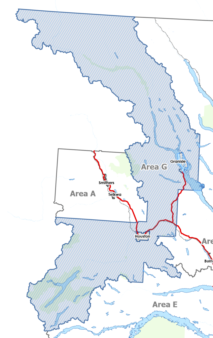
Electoral Area G (Houston/Granisle Rural) Boundaries
Western Boundary (Hwy 16):
Western Boundary (Walcott-Quick Road/Morice Telkwa Forest Service Road):
Eastern Boundary (Hwy 16):
Southern Boundary (Morice-Owen Forest Service Road):
|
 |
Local services provided by the RDBN in Electoral Area G (Houston Rural)
| Building Inspection |
| Building Numbering |
| Development Services |
| Economic Development |
| Electoral Area Planning |
| Emergency Preparedness |
| Grants-in-Aid |
| Environmental Services |
| Weed Control |
| 9-1-1 |
| Feasibility Studies |
| Liquid/Solid Waste Disposal |
| Rural Government Services |
| Recreation and Culture |
| Emergency Services |
| Television Rebroadcasting |
| Topley Cemetery |
| Topley Emergency Response |
| Rural Fire Protection |
| General Government Services |
| Planning and Zoning |